From the Ground Up: How Civiltest’s Drone Feature and Level Surveys are Changing the Game
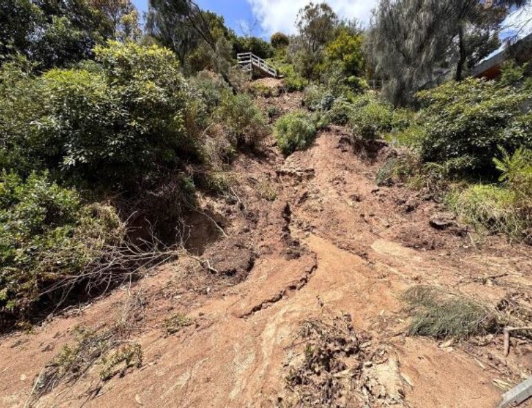
A recent project saw Civiltest performing a geotechnical assessment of a recent landslide. The aim was to determine the nature and extent of the landslide and the residual risk associated with this.
To achieve this, a feature and level survey was carried out. This type of land survey is used to measure and map the features and elevation of a piece of land. It is often required for construction projects and land development.
Civiltest collected data on the features of the land using various tools and techniques, including high-accuracy RTK GPS equipment and total stations. The data was then processed and analysed using specialised CAD and GIS software to create a detailed map of the land and its features.
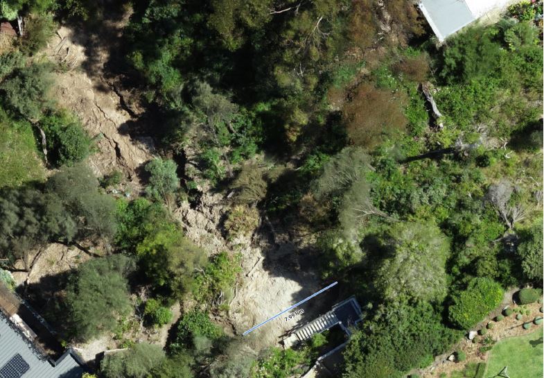
Civiltest also used a DJI M300 RTK drone with L1 LiDAR payload for a feature and topographical survey, a variant of a traditional feature and level survey that uses drones to collect data on the land. The drones are equipped with high-resolution cameras and lasers to capture high-resolution images and data from above. This data is used to create detailed maps and models of the land, including its elevation and features.
Drone surveys offer several advantages over traditional surveys. They are faster, cheaper, and sometimes safer than conventional surveying methods, as they do not require the surveyor to stand at each survey point to collect the information.
"Drone technology captures everything," said Jinke Yu, Geotechnical Engineer & Director at Civiltest. "It's not selective. Where traditional surveying is set up to collect data in a grid, the drone provides a full-scale survey of the whole site."
Drones also allow surveyors to access areas that may be difficult or impossible to reach on foot, such as steep slopes. As a result, drone surveys are becoming an increasingly popular option for construction and land development professionals.
"With drone technology, we get an accurate 3D site model, which is a true representation of the site. It also delivers a high-resolution orthomosaic image, and by clicking on any point of the image, you can check the accurate location and height information. It also allows for comparisons of site changes if multiple surveys are done for the same site and can be used to track the volume changes of stockpiled material," said Jinke.
The most rewarding part for Civiltest and our client is that because of the technology, we could have the relevant data in a matter of days, compared to weeks—should the technology not have been around.