Journey to 3D: Benefits of Using Drone Technology for 3D Feature Survey
Conducting Feature & Level surveys is pivotal for JF Studio - landscape architectural and urban design practice and holds significant importance for engineering companies like Civiltest. These surveys unravel crucial information about sites and existing structures, providing a foundation for successful project outcomes.
Jenny Yu, Director and Registered Landscape Architect of JF Studio, emphasises "The significance of these surveys in understanding existing topography, impacting factors such as wind, water, air, and wildlife flow in a given space".
For engineering companies like Civiltest, this data becomes instrumental in making informed decisions that respond to site conditions, project planning and execution.
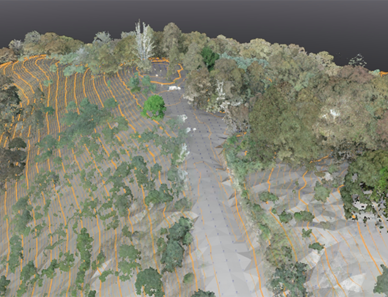
In collaboration with engineering teams, landscape designers leverage LiDAR point cloud data collected with our DJI M300RTK Drone to build digital models of existing sites, test design ideas under real conditions, and create visual renders for thorough before and after scenario evaluations. This collaborative approach ensures a project's aesthetic and functional aspects align with the landscape architecture and engineering goals.
The technological evolution from 2D to 3D presentations has significantly impacted this process. "3D has enabled the capture of more comprehensive site information," says Jenny. This technological shift reduces gaps between existing conditions and proposed designs and aids construction, providing valuable insights considered in Feature & Level surveys.
Civiltest embraces these technological advancements, for they enhance efficiency and contribute to the overall success of landscape projects, showcasing the crucial intersection between landscape architecture and engineering expertise.